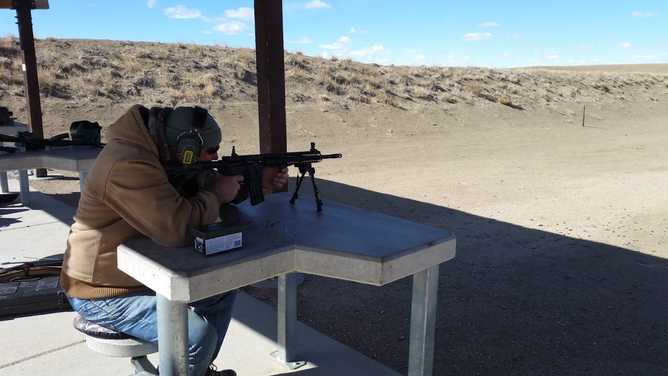
Baker Draw Designated Shooting Area
Co Rd 96, Ault, CO 80610, United States
About Baker Draw Designated Shooting Area
Located at the convergence of Weld County Roads 96 and 63, the Baker Draw Designated Shooting Area beckons firearm enthusiasts with its well-structured range and dedicated lanes. With safety as a cornerstone, this open range showcases its functionality through a host of features:
Main Features:
- Dirt berms for controlled shooting experiences
- Three distinct shooting lane distances: 25 yards, 50 yards, and 100 yards
- Designated lanes for rifles and handguns to ensure proper use
- Targets must be at least 4 feet off the ground to reduce ricochet risks
Amenities Include:
- Ample parking space
- Informational kiosk for shooter education
- Restroom facilities (Note: recent reports suggest damage; please plan accordingly)
- 30 shooting lanes with 26 benches and shade structures for comfort
- Reminder: No trash services available; visitors must take all belongings with them
Rules and Safety:
- No use of clay pigeons, tracer/incendiary rounds, or exploding targets
- Rifles and handguns only, shotguns prohibited as of June 1, 2016
- Alcohol and automatic fire are strictly forbidden
- Shooting is allowed only at designated stations and targets
- Mandatory use of eye and ear protection
Community Insights:
- Users highlight the free, public access as a significant perk
- Regulars have voiced concerns about cleanliness and safety due to irresponsible visitors
- The lack of maintenance, as evidenced by litter and vandalism, has been pointed out
- Commendations are given to those who uphold safety and range etiquette
- Reminders about the importance of following rules to preserve the range’s future
Partnerships:
- Supported by Colorado Parks & Wildlife, the NRA, and local entities
User Experiences:
- Some visitors have encountered safety concerns due to others’ behavior
- Many appreciate the range’s availability and free access
- The importance of respecting the facility and others is a recurring theme
- Safety-conscious visitors urge others to maintain the range and report rule violations
Additional Notes:
- Please be aware that some visitors have reported unsafe practices by others; vigilance is advised
- The surrounding area is closed to shooting to maximize safety
- All federal, regional, and local shooting restrictions are in effect
At a glance
- Longest distance
- 100 yards
Range details
- Range type
- Firearms
- Funding
- Built or improved with federal Wildlife Restoration (Pittman-Robertson) funds
Source: US Fish and Wildlife Service (Wildlife Restoration program), retrieved October 23, 2026. Details change; confirm with the range before you go.
- Rules
- Area closure adjacent to the Baker Draw Designated Shooting Area: Closure Order (pdf, 89KB) Map (pdf, 274KB) Shooting restrictions & closures apply
Source: USDA Forest Service, Arapaho & Roosevelt National Forests Pawnee NG, retrieved October 23, 2026. Details change; confirm with the range before you go.
- Fee
- Free
Source: OpenStreetMap contributors (ODbL), retrieved October 23, 2026. Details change; confirm with the range before you go.
Shooting and services
Photos


Location
Co Rd 96, Ault, CO 80610, United States


